Ruta Camino de Los Pinos
Ruta Camino de los Pinos, in Conchar, near to Granada is as spectacular a walk as I’ve attempted in Spain. It’s not particularly long, but it’s quite demanding. You need a head for heights and there’s a bit of a scramble up the mountain around half way. I packed a camera and lens, 1.5 litres of water and set off around 6:30pm.
The walk begins just outside Conchar, if you join it from the back road on the north side of Conchar, you can follow a gentle uphill path through the pine forest for about two miles.

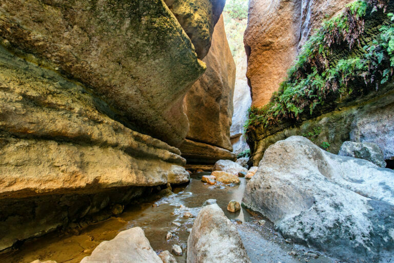
The path is relatively easy though if you don’t have a head for heights it gets a little scary as one slip could send you sliding into the Durcal River gorge. Probably at least 500 feet and potentially fatal.
After this point the path gets steeper and less distinct. More of a scramble, almost a climb in places, but eventually, you come out of the pine forest into a moorland.
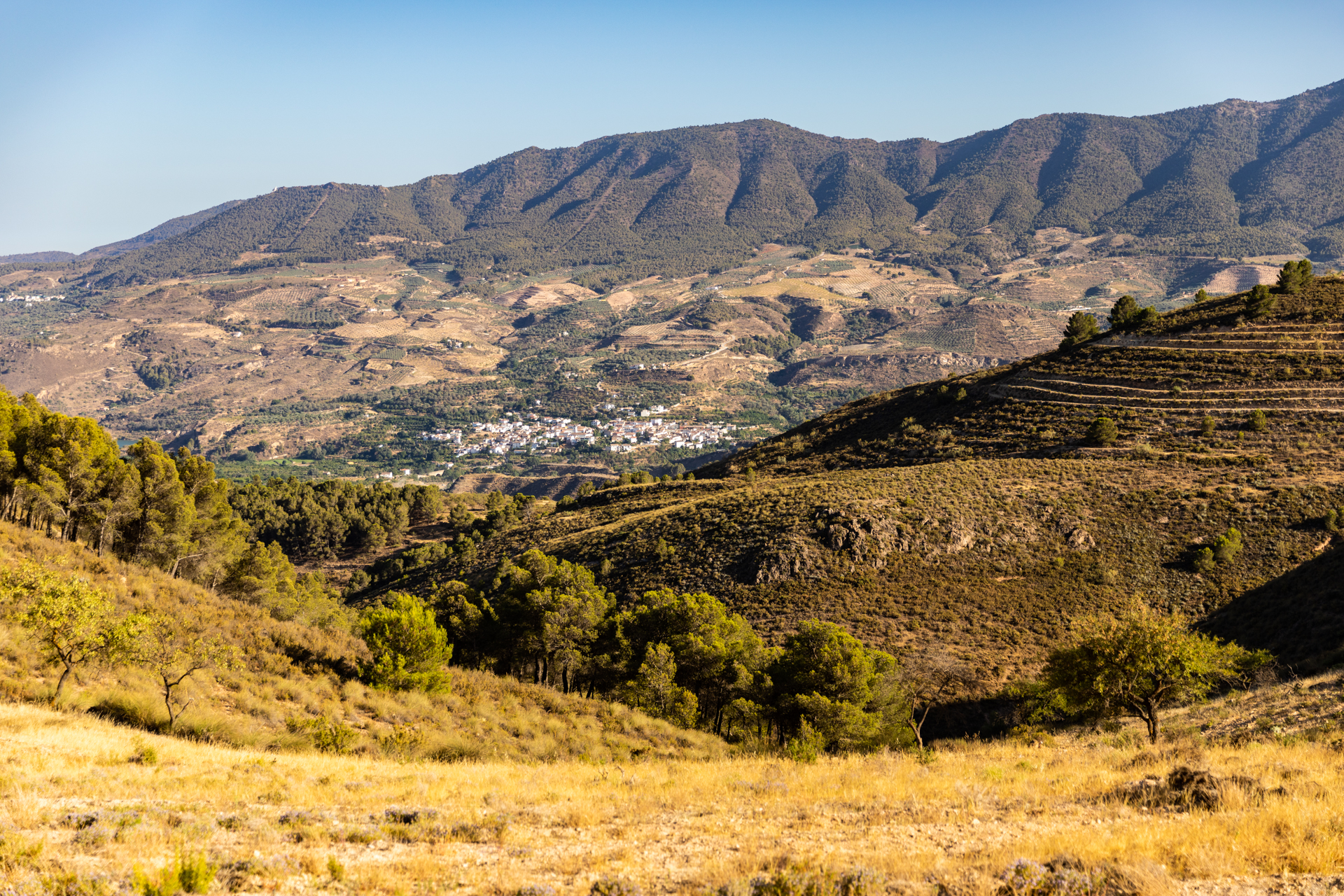
The path is marked out by piles of stones. Fortunately because the town of Albenuelas which you can see in the cover shot is the nearest civilisation in that direction and it’s about 6 miles.

Crossing this moorland you feel somewhat awed by the scale and drama of this landscape. There’s a sense of timelessness in that it really hasn’t changed too much in 500 years. I’ve read Gerald Brennan’s “South from Granada” and he talks about the Alpujarras which are the neighbouring mountains about ten miles south east of here. They are spectacular and he talks about walking to the coast, sleeping out under the stars. They were made of stern stuff in those days!
The other book that these landscapes evoke is Laurie Lee’s “As I Walked Out One Midsummer Morning“, a wonderful autobiographical book by a really great writer who walked the length of Spain in 1934.
These are the foothills of the Sierra Nevada in the distance and although this walk is demanding, it has its own rewards.

The care that has been taken to ensure the path is stable around the hill is impressive, as is the placement of the navigation markers. It would be hard to get lost, but inevitable without the markers!
Ruta Camino de Los Pinos Photography
I do this a lot these days. Rather that run at a subject and take every conceivable photograph, I take a more considered and slow approach. Todays walk was a rehearsal to shooting this landscape properly. You’d need a tripod, polarising filter and a couple of lenses. My plan is to photograph this and other walks in the Lecrin Valley comprehensively over the next year or so..
This particular walk, Ruta Camino de los Pinos needs to be shot in two sessions because of the placement of the sun. My first attempt was early evening, but to capture the terraces on the side of the Rio Durcal Gorge I needed to go out again in the early morning when the sun exposes the Conchar side of the valley and comes through the pine forest towards the camera.
In terms of panoramas, there are at least two good ones here. So a third expedition with different kit! And if astrophotography appeals, this is dark sky territory.
So this will be one of the routes I’m going to feature on my workshops next year. Keep an eye out for further announcements – in fact why not sign up to the mailing list so you can get early notification as the week long schedule comes together?
Subscribe…
I’ll keep you in the loop with regular monthly updates on Workshops, Courses, Guides & Reviews.
Sign up here and get special prices on all courses and photowalks in 2024